battle, major, interwar and Second World War
Battle of Tarawa
Battle of Tarawa was a battle fought on 20 November 1943 at Betio, in what is now Kiribati; it lasted 3 days. It was part of Q2920892. The recorded result: Allied victory.
See it on the globe Read the article

Where it sits in Q2920892
Record
| Date | 20 November 1943 to 23 November 1943 | |
|---|---|---|
| Place | Betio, Kiribati 1.427N, 172.976E | |
| Kind | Battle, interwar and Second World War | |
| Strength | 35,000 troops; 18,000 marines; 5 escort carriers; 3 battleships; 2 heavy cruisers; 2 light cruisers; 22 destroyers; 2 minesweepers; 18 transports & landing ships | 2,636 troops; 2,200 construction laborers (1,200 Korean and 1,000 Japanese); 14 tanks; 40 artillery pieces; 14 naval guns |
| Casualties and losses | U.S. Marine Corps: 1,009 killed; 2,101 wounded; U.S. Navy: 687 killed; 1 destroyer damaged by coastal guns | 4,690 killed (Both Japanese soldiers and construction laborers); 17 soldiers captured; 129 Korean laborers captured; 14 tanks destroyed |
| Commanders |
|
|


The ground today
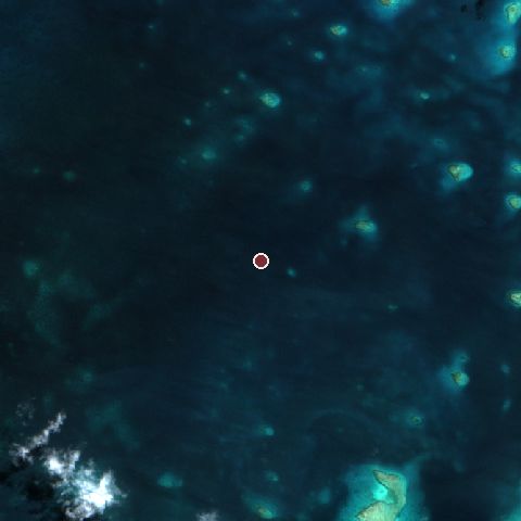
The recorded site stands at about 0 m; within 10.0 km the ground runs from 0 to 2 m, 2 m of relief, flat country and today it is 100% water.
Elevation from the Copernicus DEM GLO-30 (ESA, Airbus); land cover from ESA WorldCover 2021 (CC BY 4.0), within about 5 km of the recorded site. Computed, not recorded.Nearest engagements
- Battle of Makin 1943, 184 km N
- Battle of Drummond's Island 1841, 203 km E
- Battle of Kwajalein 1944, 997 km NW
- Battle of the Santa Cruz Islands 1942, 1316 km SW
- Battle of the Eastern Solomons 1942, 1575 km SW
In the same war
- After: Battle of Makin 21 November 1943
Elsewhere in 1943
- Battle of Kursk Soviet Union
- Third Battle of Kharkov Ukraine
- Battle of the Dnieper Ukraine
- Battle of Kasserine Passe Tunisia
- Allied invasion of Italy Italy
Combat data (CDB90)
| Attacker: US 2ND MAR DIV(-) | Defender: JAP GILBERT ISLANDS GARRISON FORCE(-) | |
| Strength | 9,000 | 4,836 |
| Casualties | 3,302 (36.7%) | 4,836 (100.0%) |
| Mission accomplishment, 1 to 10 | 7 | 4 |
| Outcome | attacker won | |
| Duration | 4.0 days | |
| Front width | 1.2 km | 1.2 km |
| Attacker advanced | 1 km | |
From the US Army Concepts Analysis Agency Database of Battles (CDB90, battle 517), public domain, in the CC0 tidy edition by Jeffrey B. Arnold. Figures are the database's estimates, compiled in 1990 from published histories, and may differ from the Wikipedia infobox above.
Battle of Tarawa is one of 2,997 engagements of the 20th century in the atlas and one of 3 in present-day Kiribati.
Sources
Identity, coordinates, dates and the war from Wikidata Q250309, released under CC0. Result, belligerents, commanders, strength and casualties from the infobox of the English Wikipedia article Battle of Tarawa, revision 1385263834, read 2026-11-14, licensed CC BY-SA 4.0; the article's text is not reproduced here. Present-day country and state from Natural Earth. Dates before 1582 follow the Julian calendar as recorded.