siege, landmark, Cold War
Siege of Sarajevo
Siege of Sarajevo was a siege conducted in the 1990s at Sarajevo, in what is now Bosnia and Herzegovina; it lasted about 6 years. It was part of the War in Bosnia and Herzegovina, which ran from 1992 to 1995.
See it on the globe Read the article
Record
| Date | the 1990s (decade precision) to 29 February 1996 | |
|---|---|---|
| Place | Sarajevo, Bosnia and Herzegovina 43.847N, 18.356E | |
| Kind | Siege, Cold War | |
| Territorial change | Eastern Sarajevo and Sarajevo divided by RS and FBiH, respectively.; 65% of buildings heavily damaged or destroyed overall. | |
| Strength | ~73,141 soldiers, militia fighters, local police and irregulars; Limited number of heavy equipment, armoured vehicles (incl. improvised) and tanks; ~2,000 soldiers | UNPROFOR; 4,600 total personnel; Rapid Reaction Force (1995); France; 2,000 soldiers; 8 AMX-30 AuF1 self-propelled artillery; United Kingdom; 1,500 soldiers; 12 L118 light gun towed howizers; Netherlands; 500 soldiers; Air campaign (1995); United States; F-16 fighter aircraft; A-10 ground-attack aircraft; MQ-1 Predator drones; France; Mirange 2000N ground-attack aircraft; United Kingdom; Jaguar ground-attack aircraft; Germany; Tornado ground-attack aircraft; Spain; EF-18A Hornet fighter aircraft; IFOR; (1995-1996); ----; Unknown |
| Casualties and losses | 6,137 killed; 3,587 wounded; Unknown | UNPROFOR; France; 20 killed (11 in accidents); 25 wounded; ~32 held hostage; 1 AMX-10 RC damaged; 1 APC captured; Ireland; 1 killed (in accident); 1 injured (in accident); Canada; 15 wounded; 16 held hostage; 1 AVGP captured; Ukraine; 2 wounded; Sweden; 1 held hostage; Denmark; 1 held hostage; Humanitarian airlift; Italy; 1 Aeritalia G.222 transport aircraft; 4 killed; Air campaign (1995); France; 1 Mirage 2000N aircraft; 2 pilots captured; United States; 1 MQ-1 Predator drone; IFOR; (1995-1996); Portugal; 2 killed; 1 wounded; Italy; 1 killed; 6 wounded; 33-37 killed; 71 wounded; 215 captured; Numerous vehicles damaged or destroyed; 2,241 killed; 5 tanks destroyed; 1 anti-air vehicle destroyed |
| Commanders |
|
|
The ground today
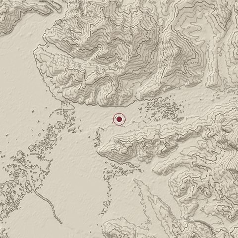
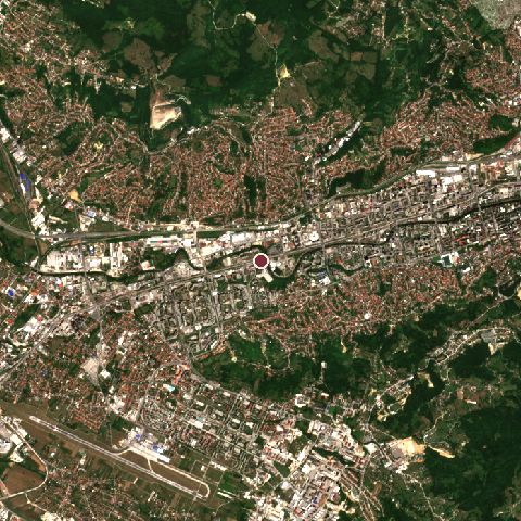
The recorded site stands at about 516 m; within 10.0 km the ground runs from 478 to 918 m, 440 m of relief, steep country and today it is 49% built-up, 37% tree cover, 12% grassland.
Elevation from the Copernicus DEM GLO-30 (ESA, Airbus); land cover from ESA WorldCover 2021 (CC BY 4.0), within about 5 km of the recorded site. Computed, not recorded.Nearest engagements
- Operation Sarajevo 1945, 5.3 km NE
- Siege of Rogatica 1941, 52 km E
- Battle of Neretva 1943, 52 km SW
- Case White 1943, 52 km SW
- Crossing the Neretva 1943, 52 km SW
Elsewhere in 1990
- Black January Azerbaijan
- Iraqi invasion of Kuwait Kuwait
- Battle of Dasman Palace Kuwait
- Battle of the Bridges Kuwait
- Battle of Failaka Kuwait
Siege of Sarajevo is one of 2,997 engagements of the 20th century in the atlas and one of 43 in present-day Bosnia and Herzegovina.
Sources
Identity, coordinates, dates and the war from Wikidata Q175653, released under CC0. Result, belligerents, commanders, strength and casualties from the infobox of the English Wikipedia article Siege of Sarajevo, revision 1385596246, read 2026-11-14, licensed CC BY-SA 4.0; the article's text is not reproduced here. Present-day country and state from Natural Earth. Dates before 1582 follow the Julian calendar as recorded.