battle, landmark, Cold War
Iraqi invasion of Kuwait
Iraqi invasion of Kuwait was a battle fought in 1990 at Kuwait. Its exact site is not recorded; the atlas places it at Kuwait. It was part of the Gulf War, which ran from 1990 to 1991. The recorded result: Iraqi victory.
See it on the globe Read the article

Where it sits in the Gulf War
Record
| Date | 1990 (year precision) to 1990 | |
|---|---|---|
| Place | Kuwait 29.167N, 47.600E | |
| Kind | Battle, Cold War | |
| Commanders |
|
|


The ground today
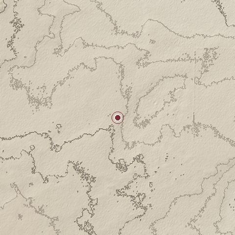
The recorded site stands at about 147 m; within 10.0 km the ground runs from 104 to 177 m, 72 m of relief, gently rolling country and today it is 100% bare ground.
Elevation from the Copernicus DEM GLO-30 (ESA, Airbus); land cover from ESA WorldCover 2021 (CC BY 4.0), within about 5 km of the recorded site. Computed, not recorded.Nearest engagements
- Battle of the Bridges 1990, 19 km N
- Battle of Dasman Palace 1990, 46 km NE
- Battle of Failaka 1990, 46 km NE
- Battle of Wadi Al-Batin 1991, 103 km W
- Battle of 73 Easting 1991, 103 km NW
In the same war
- After: Battle of Dasman Palace 2 August 1990
- All 18 engagements of Gulf War
Elsewhere in 1990
- Black January Azerbaijan
- Siege of Sarajevo Bosnia and Herzegovina
- Battle of Massawa Eritrea
- Battle of Kokavil Sri Lanka
- Defense of Yeraskh Turkey
Iraqi invasion of Kuwait is one of 2,997 engagements of the 20th century in the atlas and one of 8 in present-day Kuwait.
Sources
Identity, coordinates, dates and the war from Wikidata Q856650, released under CC0. Result, belligerents, commanders, strength and casualties from the infobox of the English Wikipedia article Iraqi invasion of Kuwait, revision 1383243347, read 2026-11-14, licensed CC BY-SA 4.0; the article's text is not reproduced here. Present-day country and state from Natural Earth. Dates before 1582 follow the Julian calendar as recorded.