Atlas of Battles

battle, major, medieval

Battle of Brunanburh

Battle of Brunanburh was a battle fought in AD 937 at Wirral Peninsula, in what is now United Kingdom. It was part of Q1379246. The recorded result: English victory.

See it on the globe Read the article

Alfred Pearseː The great battle of Brunanburh in 937 (illustration from Hutchinsons Story of the British Nation, 1922)
Alfred Pearseː The great battle of Brunanburh in 937 (illustration from Hutchinsons Story of the British Nation, 1922). Alfred Pearse, Public domain, via Wikimedia Commons.
FoughtAD 937
WhereWirral Peninsula, United Kingdom53.796N, 2.257W
OutcomeEnglish victory
BelligerentsKingdom of EnglandagainstKingdom of Dublin; Kingdom of Alba; Kingdom of Strathclyde
Part ofQ1379246

Where it sits in Q1379246

First Viking attack on England, AD 780Battle of York, AD 867Battle of Englefield, AD 870Battle of Reading, AD 871Battle of Ashdown, AD 871Battle of Basing, AD 871Battle of Marton, AD 871Battle of Chippenham, AD 877Battle of Cynwit, AD 878Battle of Edington, AD 878Battle of Buttington, AD 893Battle of Stamford (894), AD 894Battle of Tettenhall, AD 910Battle of Tempsford, AD 917Battle of Derby, AD 917Battle of Corbridge, AD 918Battle of Stamford, AD 918Battle of Brunanburh, AD 937Battle of Stainmore, AD 954Battle of Maldon, AD 991Battle of Brentford, 1016Battle of Assandun, 1016Battle of Fulford, 1066Battle of Stamford Bridge, 1066Battle of Danes Moor, 1469AD 7801469Battle of Brunanburh, AD 937
25 placed engagements of Q1379246 in time order; taller ticks are more widely documented. Each tick is a link.

Record

DateAD 937 (year precision)
PlaceWirral Peninsula, United Kingdom
53.796N, 2.257W
KindBattle, medieval
Commanders
  • Æthelstan
  • Olaf III Guthfrithson
  • Constantine II of Scotland
  • Owen I of Strathclyde
Battle of BrunanburhBattle of BrunanburhBattle of ClitheroeBattle of HeptonstallBolton MassacreBattle of PrestonBattle of BritainBattle of ClitheroeBolton MassacreBattle of BritainManchesterNewcastleLiverpoolNottinghamMiddlesbroughStokeScarboroughDouglas100 km53.796N, 2.257W
The recorded site, with the nearest other engagements in the atlas. Present-day coastlines, rivers and borders; towns from Natural Earth.

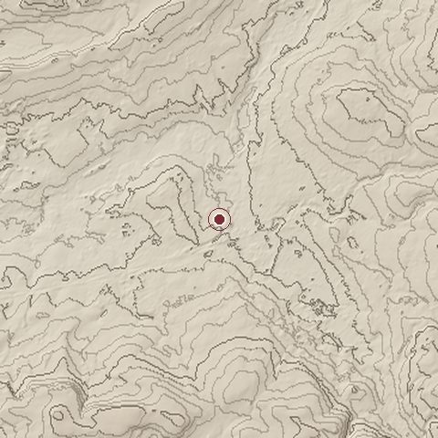
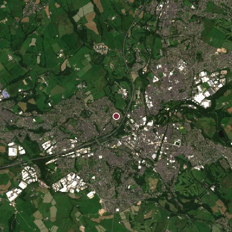
The ground today

Relief of the ground around the site of Battle of Brunanburh
Relief within about 10.0 km of the site, contours every 25 m. Copernicus DEM GLO-30, ESA.
Satellite view of the site of Battle of Brunanburh today
The same ground from Sentinel-2 on 2025-07-12. Contains modified Copernicus Sentinel data 2025.

The recorded site stands at about 123 m; within 10.0 km the ground runs from 68 to 408 m, 340 m of relief, hilly country and today it is 33% built-up, 33% tree cover, 33% grassland.

built-up: 33%tree cover: 33%grassland: 33%built-up 33%tree cover 33%grassland 33%
west to east, 10.0 km71 to 239 mnorth to south, 10.0 km91 to 319 m
Elevation from the Copernicus DEM GLO-30 (ESA, Airbus); land cover from ESA WorldCover 2021 (CC BY 4.0), within about 5 km of the recorded site. Computed, not recorded.

Nearest engagements

In the same war

Battle of Brunanburh is one of 167 engagements of the 10th century in the atlas and one of 695 in present-day United Kingdom.

Sources

Identity, coordinates, dates and the war from Wikidata Q2246615, released under CC0. Result, belligerents, commanders, strength and casualties from the infobox of the English Wikipedia article Battle of Brunanburh, revision 1381807124, read 2026-11-14, licensed CC BY-SA 4.0; the article's text is not reproduced here. Present-day country and state from Natural Earth. Dates before 1582 follow the Julian calendar as recorded.