Atlas of Battles

battle, major, Revolutionary and Napoleonic

Battle of the Bridge of Arcole

Battle of the Bridge of Arcole was a battle fought on 15 November 1796 at Arcole, in what is now Italy; it lasted 2 days. It was part of the French Revolution, which ran from 1789 to 1799. The recorded result: French victory. Recorded strength: 20,000 against 24,000.

See it on the globe Read the article

Battle of the Bridge of Arcole
Horace Vernet, Public domain, via Wikimedia Commons.
Fought15 November 1796lasted 2 days
WhereArcole, Italy45.357N, 11.277E
OutcomeFrench victory
BelligerentsFrench RepublicagainstHabsburg monarchy
Casualties and losses3,500 killed or wounded; 1,300 capturedand2,200 killed or wounded; 4,000 captured
Part ofFrench Revolution1789 to 1799

Where it sits in the French Revolution

Battle of Kerguidu, 1793Siege of Maubeuge, 1793Battle of Beignon, 1794Battle of Lifré, 1794Battle of Guémené-sur-Scorff, 1795Battle of Faouët, 1795Battle of Mario Town, 1795Battle of Grand Champ, 1795Battle of Saint-Bily, 1795Battle of Florange, 1795Battle of Argentré, 1795Battle of the Saint-Michel tumulus, 1795Battle of Auray, 1795Battle of Guémené-Penfao, 1795Battle of Sainte-Barbe, 1795Battle of Iffs, 1795Battle of Elven, 1795Battle of Josselin, 1795Battle of Plouharnel, 1795Battle of Pont-Aven, 1795Battle of Coëtlogon, 1795Battle of Quiberon, 1795Battle of Quintin, 1795Battle of Segré, 1795Battle of La Ceriseraie, 1795Battle of La Cornuaille, 1795Battle of La Croix-Avranchin, 1795Battle of Martigné-Ferchaud, 1795Battle of Heric, 1795Battle of Vieuville, 1795Battle of Boucéel, 1795Battle of St. James, 1795Battle of the Rocher de La Piochais, 1795Battle of La Croix-Avranchin, 1795Battle of La Pellerine, 1796Battle of New House, 1796Battle of Muzillac, 1796Battle of Romagne, 1796Battle of Saint M'Hervé, 1796Battle of Auverne, 1796Battle of Plaudren, 1796Battle of Maigrit, 1796Battle of Tinchebray, 1796Battle of Juvigné, 1796Battle of Locminé, 1796Battle of Auberge-neuve, 1796Battle of Piré, 1796Battle of Saint-Hilaire-des-Landes, 1796Battle of Petit-Celland, 1796Battle of Val de Préaux, 1796Battle of Valennes, 1796Battle of Saint-Aubin-du-Cormier, 1796Battle of Vire, 1796Battle of Grand Celland, 1796Battle of the Bridge of Arcole, 1796Battle of Argentré, 1799Battle of Hennerie, 1799Battle of Saint-Aubin-du-Cormier, 1799Battle of Le Mans, 1799Battle of Nantes, 1799Battle of Ballée, 1799Battle of Locminé, 1799Battle of Lorey, 1799Battle of Mont-Guéhenno, 1799Battle of Elven Tower, 1799Battle of St. James, 1800Battle of the Loc'h Bridge, 1800Battle of the Tombettes, 1800Battle of Sainte-Anne-d'Auray, 1815Battle of Cosse, 1815Battle of Redon, 1815Battle of Muzillac, 1815Battle of Auray, 1815Battle of Châteauneuf-du-Faou, 1815Battle of Guérande, 181517931815Battle of the Bridge of Arcole, 1796
75 placed engagements of the French Revolution in time order; taller ticks are more widely documented. Each tick is a link.

Record

Date15 November 1796
to 17 November 1796
PlaceArcole, Italy
45.357N, 11.277E
KindBattle, Revolutionary and Napoleonic
Strength20,00024,000
Casualties and losses3,500 killed or wounded; 1,300 captured2,200 killed or wounded; 4,000 captured
Commanders
Battle of the Bridge of ArcoleBattle of the Bridge of ArcoleBattle of CaldieroBattle of CaldieroBattle of CaldieroBattle of CaldieroBattle of ForanoBattle of CaldieroMilanVeniceBolognaBergamoParmaRavennaFerraraTrento100 km45.357N, 11.277E
The recorded site, with the nearest other engagements in the atlas. Present-day coastlines, rivers and borders; towns from Natural Earth.

The ground today

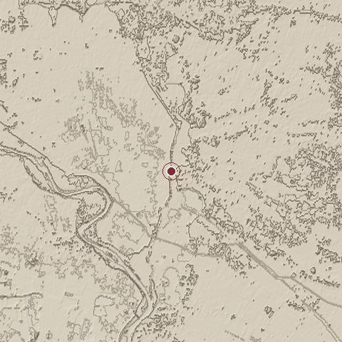
Relief of the ground around the site of Battle of the Bridge of Arcole
Relief within about 10.0 km of the site, contours every 5 m. Copernicus DEM GLO-30, ESA.
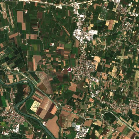
Satellite view of the site of Battle of the Bridge of Arcole today
The same ground from Sentinel-2 on 2025-09-19. Contains modified Copernicus Sentinel data 2025.

The recorded site stands at about 25 m; within 10.0 km the ground runs from 11 to 45 m, 34 m of relief, flat country and today it is 47% cropland, 34% grassland, 10% built-up.

cropland: 47%grassland: 34%built-up: 10%tree cover: 8%cropland 47%grassland 34%built-up 10%tree cover 8%
west to east, 10.0 km18 to 30 mnorth to south, 10.0 km17 to 35 m
Elevation from the Copernicus DEM GLO-30 (ESA, Airbus); land cover from ESA WorldCover 2021 (CC BY 4.0), within about 5 km of the recorded site. Computed, not recorded.

Nearest engagements

In the same war

Elsewhere in 1796

Combat data (CDB90)

Attacker: FR ARMY OF ITALYDefender: AUS ARMY
Strength17,30012,700
Casualties4,500 (26.0%)7,000 (55.1%)
Mission accomplishment, 1 to 1083
Outcomeattacker won
Duration2 days
Front width5 km5 km
Attacker advanced3 km

From the US Army Concepts Analysis Agency Database of Battles (CDB90, battle 106), public domain, in the CC0 tidy edition by Jeffrey B. Arnold. Figures are the database's estimates, compiled in 1990 from published histories, and may differ from the Wikipedia infobox above.

Battle of the Bridge of Arcole is one of 2,009 engagements of the 18th century in the atlas and one of 942 in present-day Italy.

Sources

Identity, coordinates, dates and the war from Wikidata Q776609, released under CC0. Result, belligerents, commanders, strength and casualties from the infobox of the English Wikipedia article Battle of Arcole, revision 1379687387, read 2026-11-14, licensed CC BY-SA 4.0; the article's text is not reproduced here. Present-day country and state from Natural Earth. Dates before 1582 follow the Julian calendar as recorded.