Atlas of Battles

battle, major, First World War

Kerensky Offensive

Kerensky Offensive was a battle fought in 1917 in what is now Ukraine. Its exact site is not recorded; the atlas places it at its recorded location. It was part of the WWI Eastern Front, which ran from 1914 to 1918. The recorded result: Central Powers victory.

See it on the globe Read the article

Map of the Eastern Front in the time of Kerensky Offensive in summer of 1917.
Map of the Eastern Front in the time of Kerensky Offensive in summer of 1917.. Department of Military Art and Engineering, at the U.S. Military Academy (West Point), Public domain, via Wikimedia Commons.
Fought1917
WhereUkraine49.830N, 24.014E, placed at the location, approximate
OutcomeCentral Powers victory
BelligerentsRussian Republic; Kingdom of RomaniaagainstGerman Empire; Austria-Hungary; Ottoman Empire
Part ofWWI Eastern Front1914 to 1918

Where it sits in the WWI Eastern Front

Battle of Łódź, 1914Russian invasion of East Prussia, 1914Battle of Kraśnik, 1914Battle of Rawa, 1914Battle of Krzywopłoty, 1914Battle of Bzurą 1914, 1914Battle of Stallupönen, 1914Battle of Gumbinnen, 1914Battle of Komarów, 1914Battle of Gnila Lipa, 1914Battle of Augustów, 1914Battle of Kraków (1914), 1914Battle of Limanowa, 1914Carpathian Front, 1914second battle of Krakow, 1914Battle of Bolimów, 1915Battles of Przasnysz, 1915Battle of Konary, 1915Gorlice–Tarnów Offensive, 1915Narew Offensive, 1915Siege of Novogeorgievsk, 1915Siege of Kovno, 1915Sventiany Offensive, 1915Battle of Ustechko (1916), 1916Brusilov Offensive, 1916Second Battle of Ķekava, 1916Baranovichi Offensive, 1916Kerensky Offensive, 1917Battle of Toboly, 1917Battle of Zborov, 1917Battle of Riga, 1917Battle of Jugla, 1917Battle of Moon Sound, 1917Battle of Rarańcza, 1918Battle of Bakhmach, 1918Battle of Kaniów, 191819141918Kerensky Offensive, 1917
36 placed engagements of the WWI Eastern Front in time order; taller ticks are more widely documented. Each tick is a link.

Record

Date1917 (year precision)
to 1917
PlaceUkraine
49.830N, 24.014E
KindBattle, First World War
Kerensky OffensiveKerensky OffensiveDefense of Lwów 1918–1919Battle of LwówSiege of LvivBattle of LembergBattle of LwówDefense of Lwów 1918–1919RivneRzeszówTernopilIvano-FrankivskLutskUzhgorodDrohobych100 km49.830N, 24.014E
Placed at its recorded location; the exact site is not recorded. with the nearest other engagements in the atlas. Present-day coastlines, rivers and borders; towns from Natural Earth.

The ground today

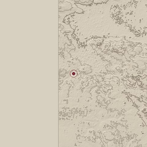
Relief of the ground around the site of Kerensky Offensive
Relief within about 10.0 km of the site, contours every 25 m. Copernicus DEM GLO-30, ESA.
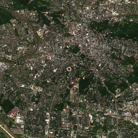
Satellite view of the site of Kerensky Offensive today
The same ground from Sentinel-2 on 2023-08-29. Contains modified Copernicus Sentinel data 2023.

The recorded site stands at about 310 m; within 10.0 km the ground runs from 0 to 407 m, 407 m of relief, steep country and today it is 58% built-up, 39% tree cover.

built-up: 58%tree cover: 39%built-up 58%tree cover 39%
west to east, 10.0 km0 to 370 mnorth to south, 10.0 km265 to 358 m
Elevation from the Copernicus DEM GLO-30 (ESA, Airbus); land cover from ESA WorldCover 2021 (CC BY 4.0), within about 5 km of the recorded site. Computed, not recorded.

Nearest engagements

In the same war

Elsewhere in 1917

Kerensky Offensive is one of 2,997 engagements of the 20th century in the atlas and one of 301 in present-day Ukraine.

Sources

Identity, coordinates, dates and the war from Wikidata Q690308, released under CC0. Result, belligerents, commanders, strength and casualties from the infobox of the English Wikipedia article Kerensky offensive, revision 1370625642, read 2026-11-14, licensed CC BY-SA 4.0; the article's text is not reproduced here. Present-day country and state from Natural Earth. Dates before 1582 follow the Julian calendar as recorded.