Atlas of Battles

battle, landmark, Cold War

Battle of Dien Bien Phu

Battle of Dien Bien Phu was a battle fought on 13 March 1954 at Điện Biên Phủ, in what is now Vietnam; it lasted 55 days. It was part of First Indochina War, which ran from 1946 to 1954. The recorded result: Viet Minh victory.

See it on the globe Read the article

An image of Viet Minh troops planting their flag over the captured French headquarters at Dien Bien Phu, 1954.
An image of Viet Minh troops planting their flag over the captured French headquarters at Dien Bien Phu, 1954.. Vietnam People's Army, Public domain, via Wikimedia Commons.
Fought13 March 1954lasted 55 days
WhereĐiện Biên Phủ, Vietnam21.387N, 103.016E
OutcomeViet Minh victory
BelligerentsFrench Union; French Fourth Republic; State of Vietnam; United StatesagainstDemocratic Republic of Vietnam; Viet Minh; China
Part ofFirst Indochina War1946 to 1954

Where it sits in First Indochina War

Battle of Hanoi, 1946Battle of Phu Tong Hoa, 1948Battle of Cao Bang, 1949Battle of Dong Khe, 1950Battle of Route Coloniale 4, 1950Battle of Vinh Yen, 1951Battle of the Day River, 1951Battle of Nghia Lo, 1951Battle of Hoa Binh, 1951Battle of Nghĩa Lộ, 1952Battle of Na San, 1952Battle of Muong Khoua, 1953Battle of Mang Yang Pass, 1954Battle of Dien Bien Phu, 195419461954Battle of Dien Bien Phu, 1954
14 placed engagements of First Indochina War in time order; taller ticks are more widely documented. Each tick is a link.

Record

Date13 March 1954
to 7 May 1954
PlaceĐiện Biên Phủ, Vietnam
21.387N, 103.016E
KindBattle, Cold War
Commanders
  • Henri Eugène Navarre
  • Christian de Castries
Battle of Dien Bien PhuBattle of Dien Bien PhuBattle of Muong KhouaBattle of Na SanBattle of Lima Site 85Battle of Nghia LoBattle of Muong KhouaBattle of Na SanBattle of Lima Site 85Battle of Nghia LoLao ChiXam NuaLuan ChauPhongsaliLouang Namtha100 km21.387N, 103.016E
The recorded site, with the nearest other engagements in the atlas. Present-day coastlines, rivers and borders; towns from Natural Earth.

The ground today

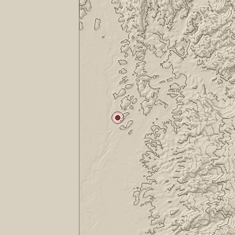
Relief of the ground around the site of Battle of Dien Bien Phu
Relief within about 10.0 km of the site, contours every 50 m. Copernicus DEM GLO-30, ESA.
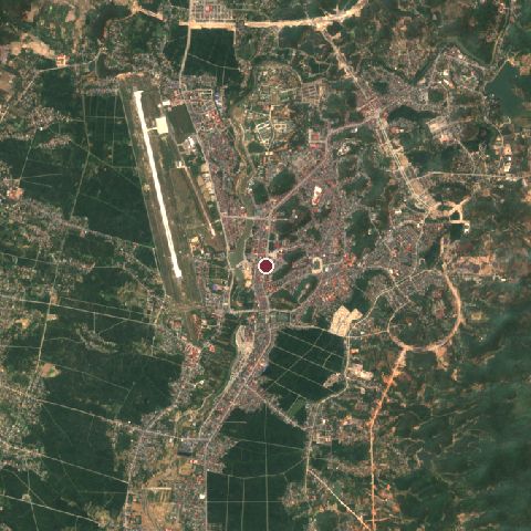
Satellite view of the site of Battle of Dien Bien Phu today
The same ground from Sentinel-2 on 2025-04-10. Contains modified Copernicus Sentinel data 2025.

The recorded site stands at about 486 m; within 10.0 km the ground runs from 0 to 994 m, 994 m of relief, mountainous country and today it is 39% cropland, 29% tree cover, 26% built-up.

cropland: 39%tree cover: 29%built-up: 26%grassland: 4%cropland 39%tree cover 29%built-up 26%grassland 4%
west to east, 10.0 km0 to 812 mnorth to south, 10.0 km476 to 530 m
Elevation from the Copernicus DEM GLO-30 (ESA, Airbus); land cover from ESA WorldCover 2021 (CC BY 4.0), within about 5 km of the recorded site. Computed, not recorded.

Nearest engagements

In the same war

Elsewhere in 1954

Battle of Dien Bien Phu is one of 2,997 engagements of the 20th century in the atlas and one of 140 in present-day Vietnam.

Sources

Identity, coordinates, dates and the war from Wikidata Q604897, released under CC0. Result, belligerents, commanders, strength and casualties from the infobox of the English Wikipedia article Battle of Dien Bien Phu, revision 1383919193, read 2026-11-14, licensed CC BY-SA 4.0; the article's text is not reproduced here. Present-day country and state from Natural Earth. Dates before 1582 follow the Julian calendar as recorded.